
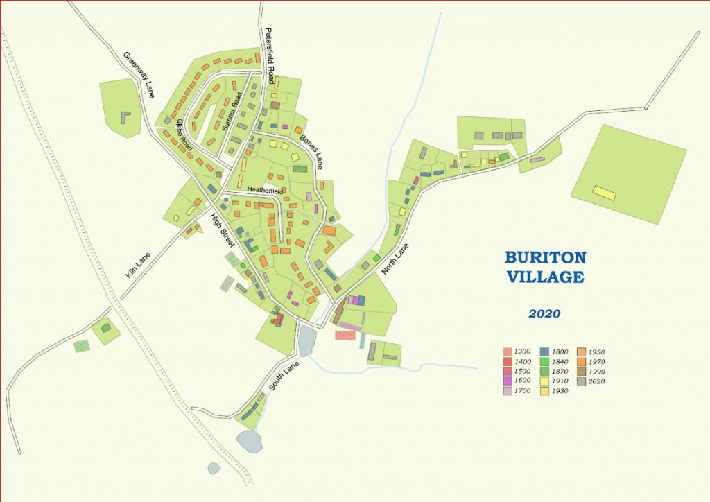
The Buriton Village Association has been able to demonstrate how the village has grown between c.1100 and the present, by digitally overlaying information from maps and other sources.
The aim of the project was to show the way in which the parish has changed and grown through the centuries, posting the maps on-line first and then in print, once any mistakes have been corrected.
First, source material was gathered: maps, censuses, house deeds, wills, sales particulars, electoral rolls etc. An Excel worksheet, listing every house with information on the year/period it was built, owner/occupants and other details – was used to arrange the information from the various sources.
The first reliable map available was a map of the estates of Lord Stawell in Buriton and Petersfield by the surveyor James Wyburd of 1793 (HRO: 56M75/E/P1 and 57M78/E/R1). For houses older than that source material was more difficult to find, so the help of a house detective, Dr Annabelle Hughes, was most welcome and confirmed that several of the houses are of medieval origin.
Initially, much time was wasted drawing maps by hand, so it was a great advance to get the help of Cllr Robert Mocatta – now the Chairman of the East Meon History Group – and a friend with IT skills, who helped to produce the maps on the free QGIS programme. It was then possible to create multiple layers on which to draw roads and buildings in different colours for each chosen date. Georeferencing allows layers to be switched on and off, if necessary, to show the village at any given period, adding or removing details as necessary.
The Buriton project has demonstrated how the evolution of any village or town can be studied, with limitless possibilities for the information that can be attributed to a dwelling through time.
Contributed by Daniela Jones.
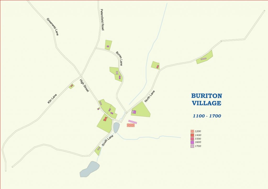
100 – 1700: There would no doubt have been a few more buildings in Buriton during this period. However, the lack of any maps and the fact that the houses would not have been as substantial as the surviving ones means that their location and numbers are unknown
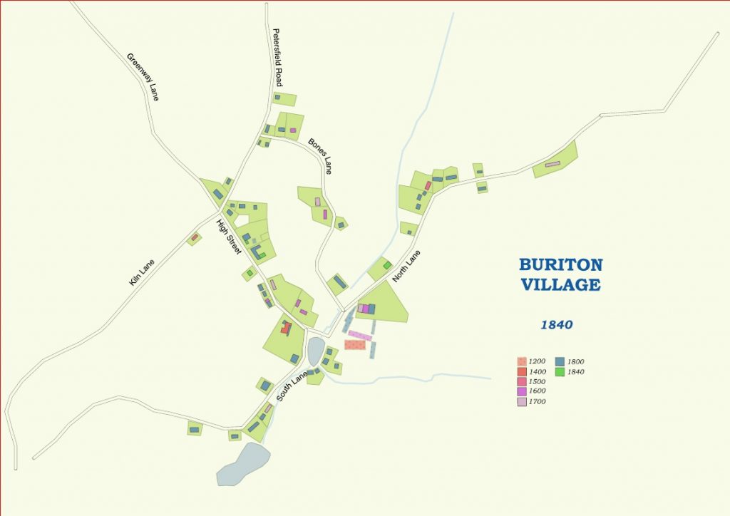
1800: The Wyburd map of the Stawell estates of 1793 (HRO: 56M75/E/P1 and 57M78/E/R1) is the first, relatively accurate map to show what Buriton looked like. Many dwellings housed several families, who depended on their craftsmanship and agriculture for a living. The poorhouse had been built in 1791
1840: Only the east wing of the poorhouse and the school house seem to have been built in the 40 preceding years
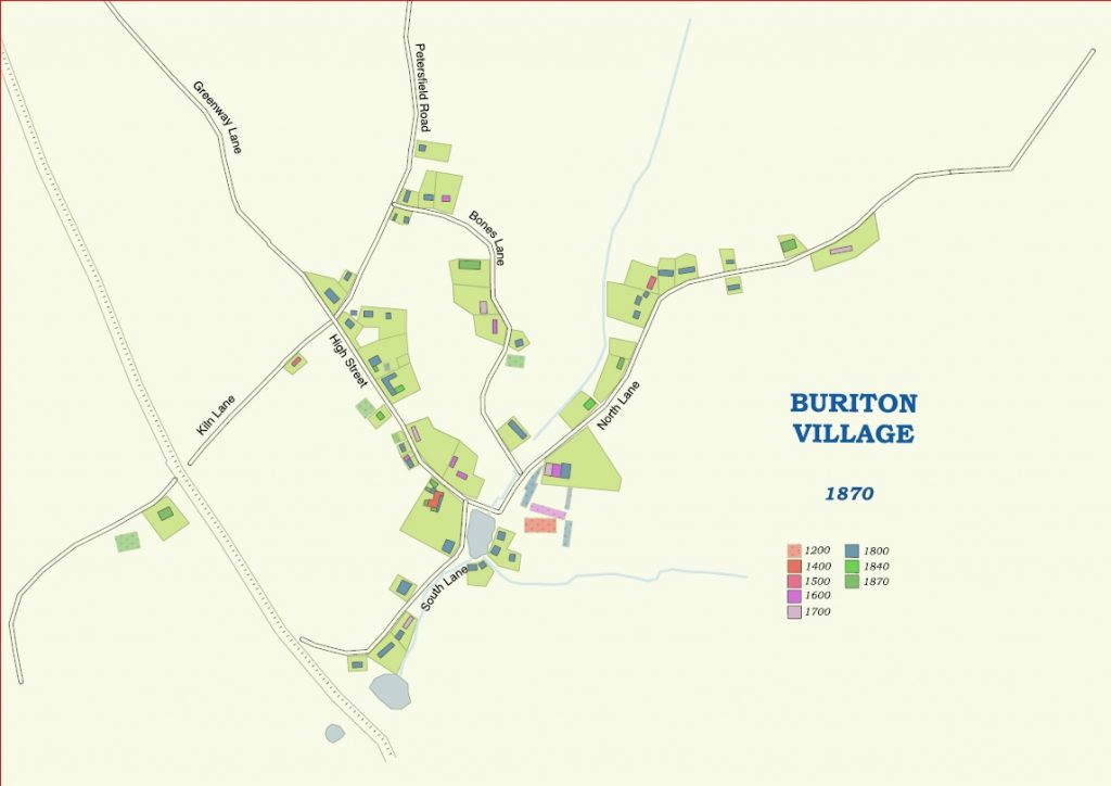
1870: Started in 1853, the ‘Portsmouth direct’ railway from London is in place. A bridge now crosses Kiln Lane, at least two cottages in South Lane have been demolished to make way for it, and Wooliff Pond has been cut in two.
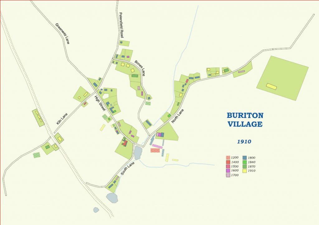
1910: Railway workers cottages appear along the railway line on either side of Kiln Lane. On the map appear the Men’s Social Club (previously the village hall) and Buriton House, built in 1910 for the lord of the manor, Lothian Bonham Carter.
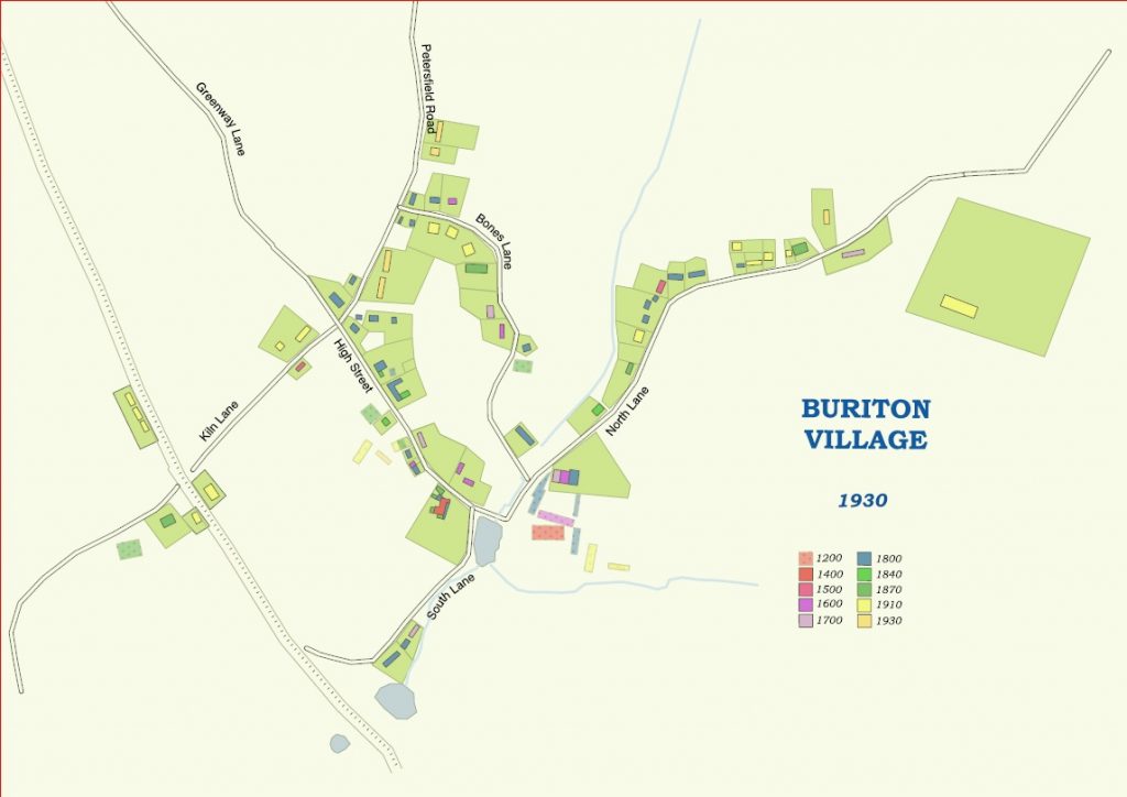
1930: Three new6 rows of houses appear in Petersfield Road, to provide homes for families, long after WWI.
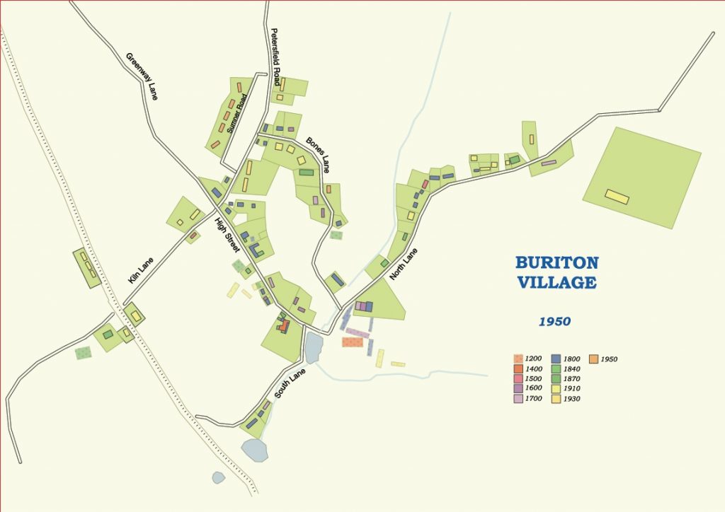
1950: Ten semi-detached houses in Sumner Road provide new homes for people after WW2.
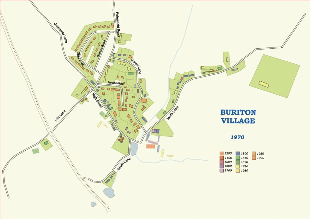
1970: A huge explosion of house-building in Glebe Road and Heatherfield must have made Buriton a very noisy place to live in for some while! The inhabitants, who had previously been mainly agricultural workers, now had a range of different jobs and professions which brought prosperity and the need for more housing.
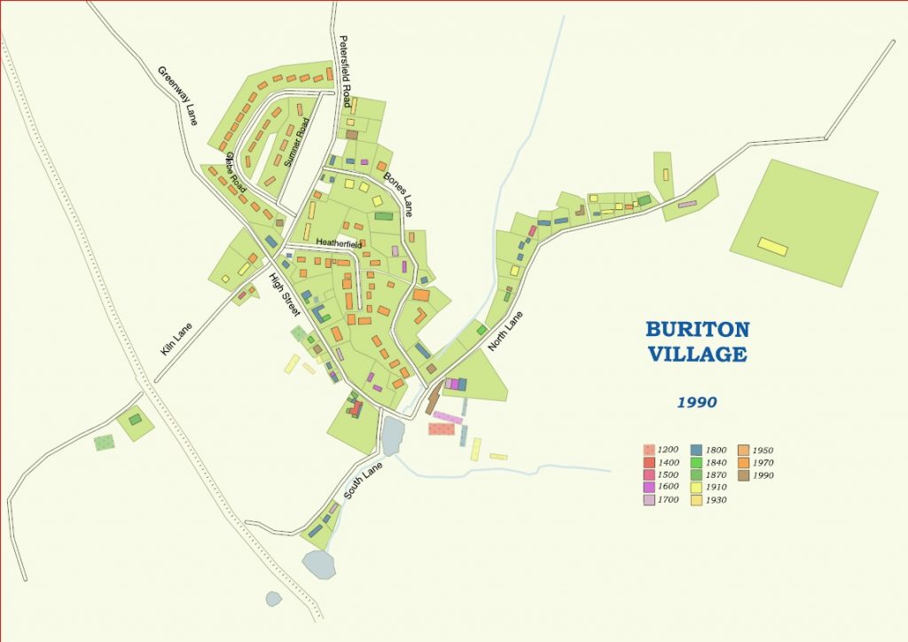
1990: Only three new houses had been built in the previous 20 years.
Approaching 2020: The pace picks up again, with new houses between Sumner and Petersfield Road, several new dwellings behind North Lane and the conversion into residential units of several farm buildings around the Manor House.
